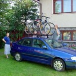
Day 1

We were aiming for Banska Bystrzyca our first day - an unrealistic goal, as we eventually found out. Things were going well until somewhere around 80 km, when the road began sloping upward. The gentle slope soon became a several-kilometer camel's hump with the serpentine road around it with no end in sight (or imagination).
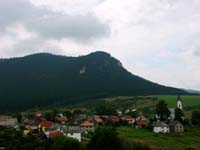
The day started rainy, then turned to muggy/steamy when we hit the major mountain leading up to Donovalay.
First, there was the rain, which made it necessary to wait in Oravski Podzamok for some time. Once we got back on the road, there were several memorable villages. After 101 km, we called it a day and got a nice room for a nicer price in Donovalay.
Day 2

The longest day of the trip, kilometer-wise, but in many ways the easiest day (except for the first few kilometers out of Zvolen). Having fallen more than 20 km short of our first day goal, we knew we had to make it up the second day, but fortunately the going was much easier. It began with about a 500 meter climb to the top of the hill that had stopped us in our tracks the day before, but this quickly gave way to a 20+ km downhill run, including an initial 12 km that was so steep that it made the side we'd ascended seem like a bump in the road. All told, we made 127 km on the second day.
The first stop, after an easy downhill beginning, was Banska.
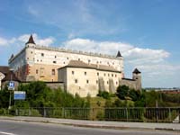
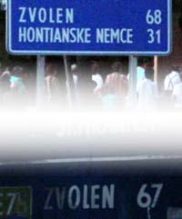
About two hours later, we stopped at the castle in Zvolen. It was getting dangerously hot by this time, and the sign just outside of town which read "Sachy 69km" didn't help much.
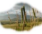
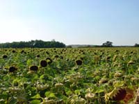
Just before arriving in Sachy, we suddenly found ourselves riding between huge fields of sunflowers.
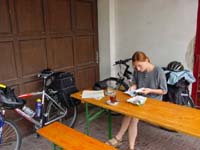
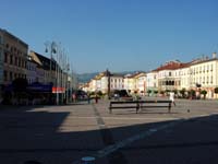
We finally made it, and got a room in literally the first hotel we found (which turned out to be the best hotel of the whole trip, both as far as price and quality go).
A quick bite to eat in the restaurant and then we were off to explore the city a bit - really just a short walk to stretch our legs.
It was then that we discovered that signs indicating distance between cities are less than 100% accurate. These two signs were in the city square, less than 50 meters apart.
Day Three


In theory - which in this case means nothing more than "in our imaginations" - this was supposed to be the easiest day. The shortest distance for a single day (we were estimating between 80 and 90 km), anyway, and that logically made it the easiest day in our imaginations.

Making it into Hungary was a few-kilometer, simple affair, and the road in Hungary started out pleasantly enough: small rolling hills with nothing terribly challenging.

Then came the bigger hills, and then the even larger ones. And the Hungarian sun appeared. And the Hungarian roadside trees all but disappeared. It was a miserable, disgusting day.

We finally made it to the half-way point: Vac. After a ride around the city square and a glance at the basilica, we collapsed on the bank of the Danube for quite a while before taking on the final, and mercifully flat, 53 km into Budapest.

We finally made it into Budapest, found our accommodations and set off looking for a restaurant.

| Summary | km | mi |
| Jablonka - Donovalay | 101 | 62.7 |
| Donovalay- Sachy | 127 | 78,9 |
| Sachy - Budapest | 93 | 57.8 |
| Budapest - Sturovo (return) | 83 | 51.5 |
| Total | 404 | 251 |